Vague Error
 Malus
Posts: 370
Malus
Posts: 370
I was trying to open a relatively large TIFF file image thing and received this error.
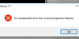
this.PNG
948 x 410 - 128K
Post edited by Malus on
Daz 3D is part of 
Connect
DAZ Productions, Inc.
7533 S Center View Ct #4664
West Jordan, UT 84084
Licensing Agreement | Terms of Service | Privacy Policy | EULA
© 2025 Daz Productions Inc. All Rights Reserved.
Comments
Malus - what is a "relatively" large TIFF? As a 32 bit application, Bryce can only handle 2 GB - though you can make it Large Address Aware and then can go to around 3.2 to 3.5 GB. Probably, you know that already. Otherwise, it could be a TIFF type not supported like e.g. GeoTIFF which has the data as double reals (64 bit) or those with single reals (32 bit). Bryce accepts 8/24 bit colour TIFF and 16 bit unsigned integer grey scale - it depends on how you load/import it.
Yes, I would have had many a crash with some large .tiff files, however, if the work isn't that important, I turn the .tiff into a .jpeg, which can be much smaller where it then doesn't cause any crashes. Yes, unlike the .jpeg, the .tiff has lossless compression in-built, which is better, but sometimes if this latter attribute isn't necessary and causing problems, then .jpeg, or some other format-type change helps (as you seem to like the PNG format, try changing the .tiff to such - might reduce crashes). But as Horo suggests, do get the LAA going, too - it costs nothing (download, usually the leftmost zip file, from the 'Attachment' section in the website), and also read the comments to see if it suits your OS.
Jay
I turn mine into PNG rather than jpg. Bryce reads PNGs and also reads PNGs with built in alphas, so very handy.
Yes, PNG can also save 16 bit grey scale, JPG is always 8 bit. At least for the TE, this is an important difference.
I converted it to PNG works as well but I think it wasn't beyond a few hundred megs. I still cannot get the results I want though so I am going to make a base and build the rest by hand. Tall walls in any terrain generator I have learned are not really good for UV mapping. So mostly you have to do box modeling instead. I wish that with terrain programs they would use some other mathematical formula so that when you have something that is almost a straight up wall it would add a few more edge loops instead of stretching it. Maybe some auto retopo or hand retopo or something. Because pretty much with straight walls you get diagonal triangles stretched beyond ridiculous proportions.