Landscape for Carrara
 Jamy
Posts: 192
Jamy
Posts: 192
One other way to built landscape :
https://graphicriver.net/item/3d-map-generator-atlas-from-heightmap-to-real-3d-map/22277498?s_rank=6
I think it could be a good way to built mountains, objects or faces and then import in Carrara (.obj).
Just need Photoshop ... and $21
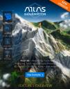
generator.jpg
584 x 741 - 211K
Daz 3D is part of 
Connect
DAZ Productions, Inc.
7533 S Center View Ct #4664
West Jordan, UT 84084
Licensing Agreement | Terms of Service | Privacy Policy | EULA
© 2025 Daz Productions Inc. All Rights Reserved.
Comments
.
Yes, I have been very disappointed at some of the terrain mapping products out there and their dependency on PS versions above PS6!
Over the spring I have been working with QGIS which is open-sourced, and now they have released a new edition. Between QGIS and the British Geological Survey maps, I can make my own heightmaps, then use whatever overlays I need for texture. I am finally making real progress with my palaeo-landscapes which take up all my time now.
Simulating landscapes in 3D
The rumors are true. QGIS 3 now brings an interactive, fully integrated interface for you to work in 3D. A year ago, QGIS relied on plugins like qgis2threejs. Whereas now, QGIS 3 has adopted 3D natively. We’re genuinely excited about this one. It’s slick and has the power to transform your data and visualizations.
https://gisgeography.com/qgis-3/
http://terrain.party/
I see it's working again properly... there was trouble with it a while ago which was why I went looking for another source for heightmapping. You did an excellent overlay with a Google Earth image of your country if I recall? Silene
This is really cool, thank you. I'm visiting my Dad, a former pilot and airline guy. He and I have been creating landscapes for some of his favorite travel experiences. I've been taking the heightmaps and dropping them in Carrara's terrain modeler.
BRYCE
Thanks J'amy that's terrific
Flash, have you checked out Cripemans excellent tutorial, Bryce Terrains to Carrara Terrains :-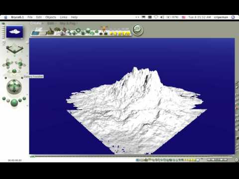
I believe the newly released (open source) DCG plugins for Carrara has a DEMs (digital elevation map) converter that can take real USGS locations (and others) and import them into Carrara. It may well be able to re-work/import other formats (terragen, etc.) as well (I think it can).
--ms
On my to-do list !!!!!